BACKGROUND: GNSS spoofing in China and beyond
29 June 2021
Global Navigational Satellite System (GNSS) spoofing is an ongoing concern for the maritime industry. Ships have reported a number of cases of GNSS interference and jamming in the eastern and central Mediterranean Sea, the Persian Gulf and multiple Chinese ports. In this briefing, analyst Katie Zeng Xiaojun provides background and recommendations for this threat.
By Katie Zeng Xiaojun, north, south and central Asia analyst
The interference and jamming of GNSSs have resulted in the loss of or false signals, affecting vessels' navigation and communication equipment. Ships have reported a number of cases of GNSS interference and jamming in the eastern and central Mediterranean Sea, the Persian Gulf and multiple Chinese ports, and GNSS spoofing could potentially paralyse shipping lanes, increase navigation risks, and attract malicious actors to use it to mask illegal activities.
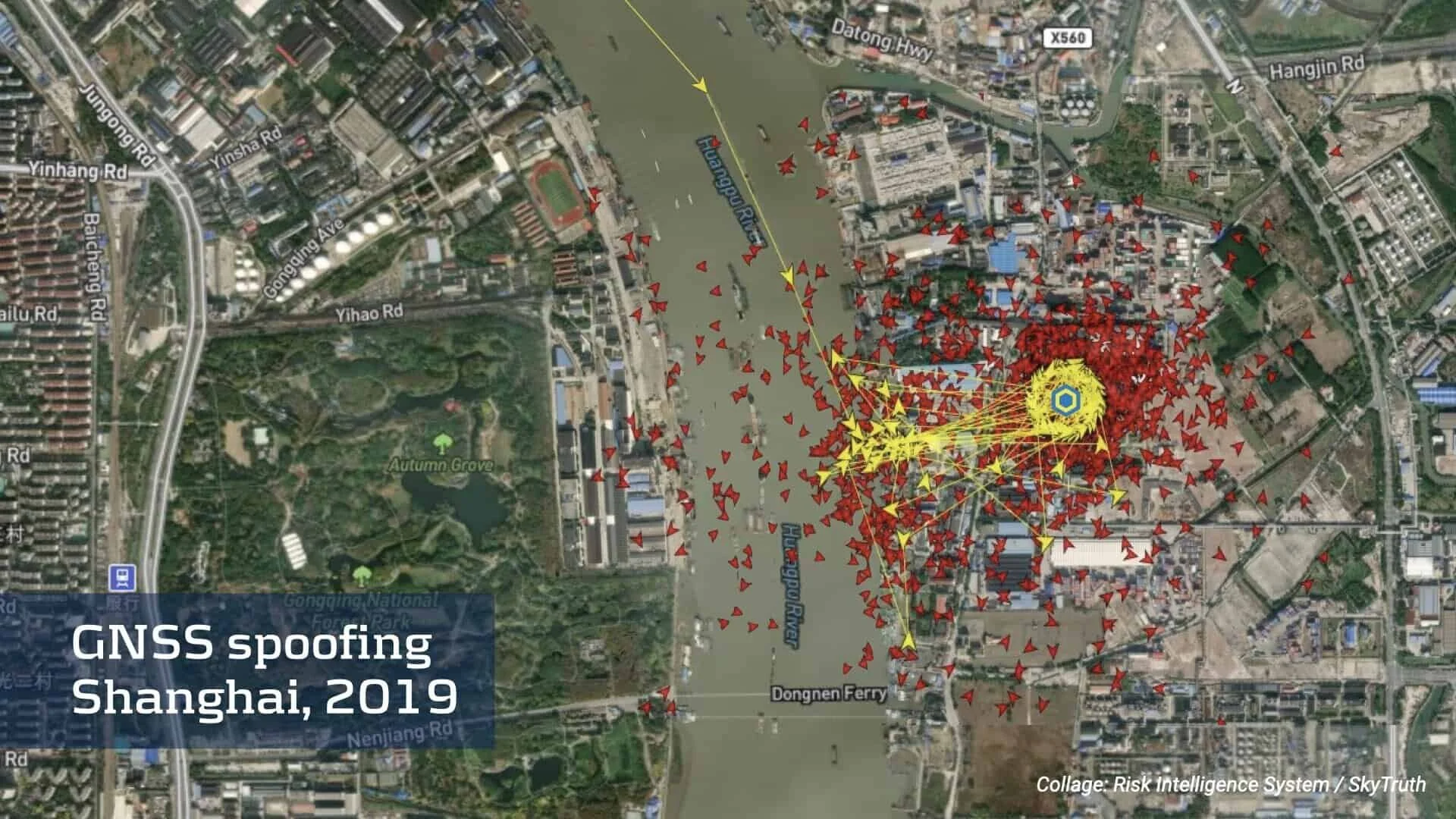
GNSS spoofing was detected in Port of Shanghai, China, in 2019. The spoofing was different when compared to other incidents, where a number of commercial vessels were reporting false positions. False circling tracks from vessels were detected inland. The intention of manipulating the GNSS was unclear, and whether it was state or non-state actors who were manipulating the data. Subsequently, it was suggested that the Chinese state was responsible for the spoofing to either act as a security measure to mask oil terminals and critical government installations or to prevent monitoring of oil imports. As well, there were accusations that sand or petroleum smugglers might have engaged in the manipulation.
The more common GNSS spoofing incidents are when the vessels transmit fake locations via the Automatic Identification System (AIS). In 2020, criminal actors were discovered using GNSS spoofing to aid their illicit activities overseas. A fleet of Chinese fishing vessels was misreporting their locations to mask illegal fishing activity. The ships were reporting a location off New Zealand via AIS. However, the ships were near the Galápagos Islands, Ecuador, where illegal fishing activity frequently occurred.
While GNSS spoofing has previously been a concern in the defence domain, affecting naval operations, it is now impacting the commercial shipping field. As GNSS spoofing equipment becomes easier to acquire, new actors could look at the benefits of spoofing. This might include state actors pursuing political goals. In 2019, some ships in the Strait of Hormuz detected satellite navigation anomalies. There was speculation that Iran could use GNSS spoofing to induce them to deviate into Iranian's territorial waters for seizure.
China now has its operational BeiDou Navigation Satellite System, which is a separate GNSS to other systems such as the US's GPS and the EU's Galileo. China might now have more freedom to interfere with GNSS to pursue tactical and strategic advantages. Exact maritime boundaries are important for China. Following the Iran example, China might see some political or commercial benefits in misrepresenting the positions of certain vessels at certain times. This could increase GNSS spoofing cases in the areas near ports and contested waters, particularly in the South China Sea.
There is often an underreporting of GNSS spoofing incidents, particularly if the result is navigation errors. However, if all vessels report any cases of GNSS interference to the relevant authorities, it will help to identify new threat areas, establish the root causes, and introduce ways to mitigate such incidents in the future.
LEARN MORE:
Get in touch for a free trial of the Risk Intelligence System to stay updated on spoofing and other threats.
Fill in the form to receive a 2 week free trial for up to five users with free access to all reports and the 24/7 Duty Watch Team.

